iDig CONNECT 2D+ System
with Skid Steer Software
Precise Grade Guidance. Simple. Fast. Proven.
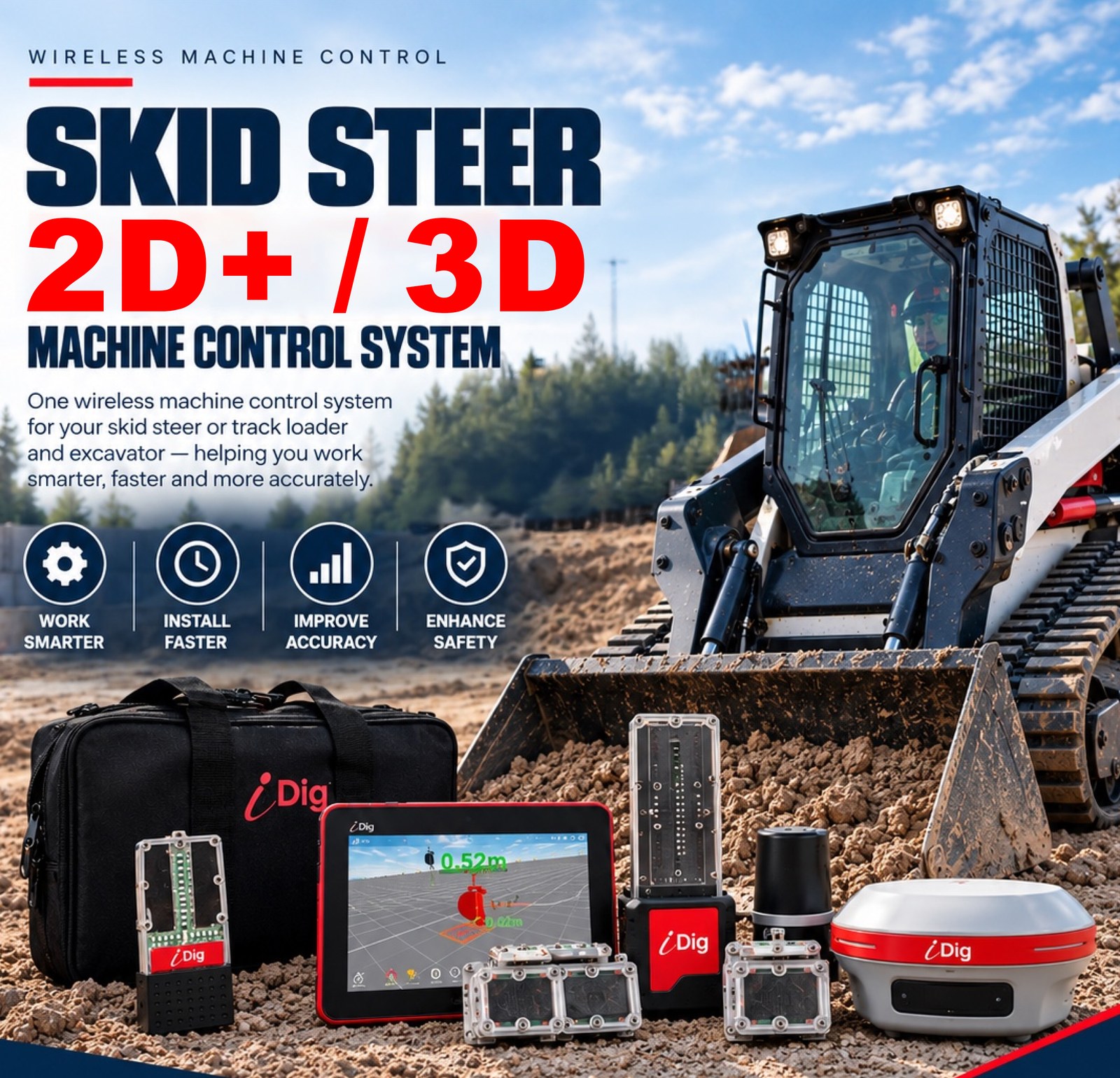
Real-time depth and slope guidance delivered straight to the cab — from solar-powered, magnetic, completely wireless sensors that install in an afternoon and move between machines in minutes. No cables. No welding. No base station. No grade checker standing in the hole.
iDig CONNECT 2D+ System with Skid Steer Software
Before you order: this package needs a GNSS base station or rover. A skid steer works from satellites, not a laser, so the system will not operate without one. Already own a base station or GPS rover? You are set — order as it is. If you do not, you will need to add one; both options are priced further down this page, or call 1-877-866-5721 and we will confirm your existing kit works with it.
Built and supported by Contractors-Tools.com — your authorized iDig source.
 U.S. PATENTED
SOLAR SENSORS
Wireless, rugged and built for real job sites.
 NO WIRES
BLUETOOTH CONNECTIVITY
Simple, reliable and clutter-free.
 ONE SYSTEM
MULTIPLE MACHINES
Move it from machine to machine in minutes.
 EASY
EASYSELF-INSTALL
Get to work faster with minimal downtime.
 LOCAL USA
SUPPORT
North American sales and support backed by a global organization.
One System.
Multiple Machines.
Get more from one machine-control investment.
iDig's wireless, solar-powered sensor technology gives contractors the flexibility to use the same machine-control system across compatible excavators and skid steers.
Move the system from machine to machine without permanently wiring it into just one piece of equipment.
Excavator use requires the Excavator License (CT156) — see the software table below.
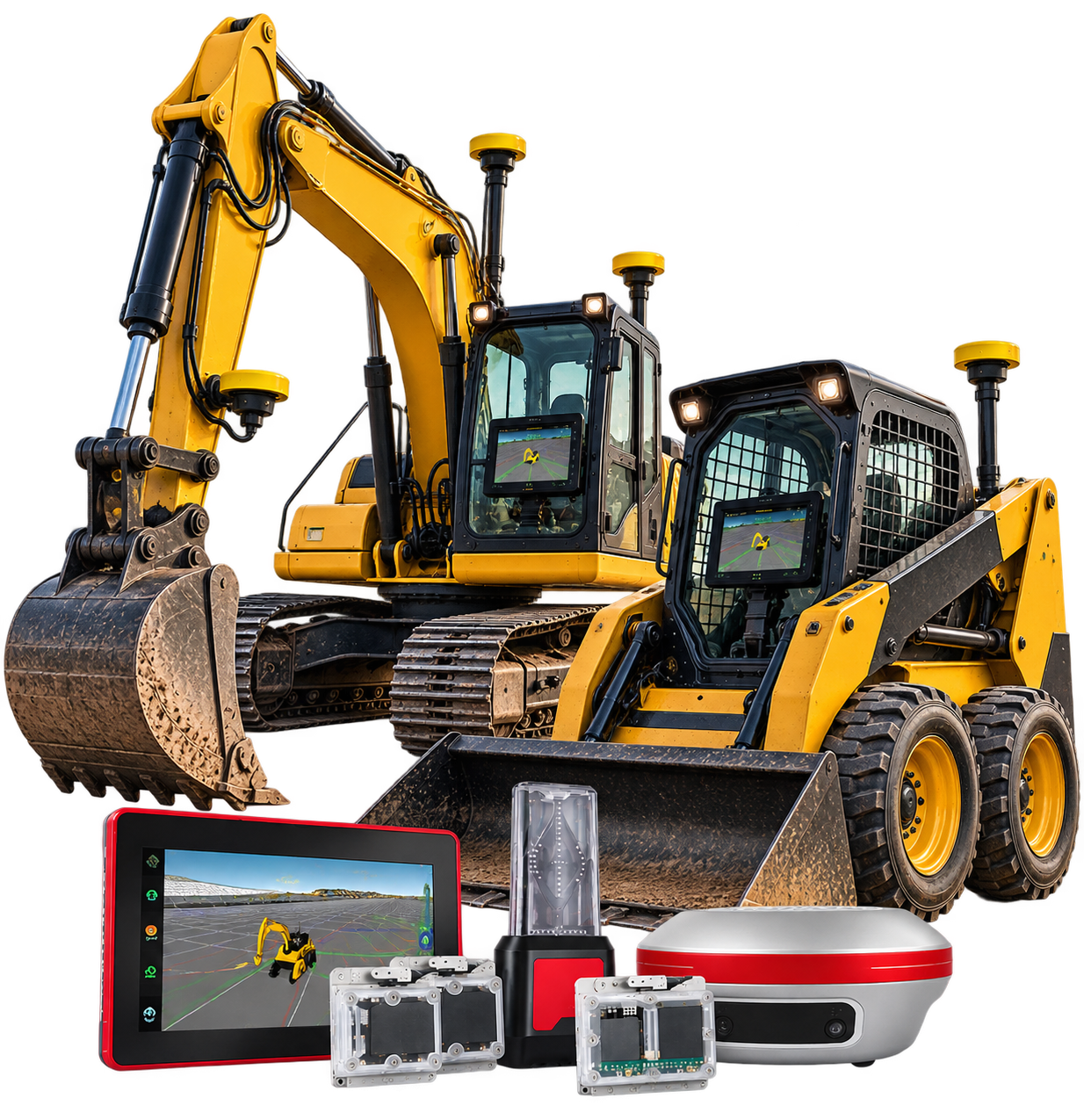
One Platform, Four Directions
Everything below runs on the hardware in this package. Nothing here is a different system you would have to buy instead — it is where this one can go when the work asks for it.
2D+ Machine Control
Grade guidance for excavators and skid steers with real-time depth and slope feedback.
3D Machine Control
Full 3D positioning for complex site designs and precision earthworks.
Skid Steer Combo
The same iDig system adapted for skid steer machine control applications.
Wireless Solar Sensors
U.S. patented solar-powered sensors — no cables, less installation time and maximum flexibility.
What is 2D+ Machine Control?
Sensors on the boom, stick, bucket and machine body track exactly where your cutting edge is — 100 times a second. Set your grade once, and the cab tells you where the bucket is against it on every pass.
Set your reference
Shoot a benchmark, catch a laser, or take a GPS elevation. Then dial in the target depth, elevation or slope you need. That reference is held for the whole excavation.
Dig and watch the bargraph
Green, red and orange LEDs sit in your field of vision and tell you whether the cutting edge is above, below or on grade — without looking away from the work or stopping the machine.
Hit grade the first time
No climbing out to check with a tape or a grade rod. No grade checker standing in the hole. No over-excavation to backfill and pay for twice.
Why 2D+ and not 3D?
3D machine control needs a digital terrain model and satellite positioning before it can do anything. 2D doesn't. You work from a benchmark, a laser or a target depth — so there is no base station, no correction subscription, no model to build and nothing to go wrong when the sky is blocked.
For trenching, foundations, drainage, utilities, landscaping, ponds, roadwork, site prep and slope work — the bread and butter — that is all the system you need, and it starts paying the day it goes on the machine.
Watch the Video
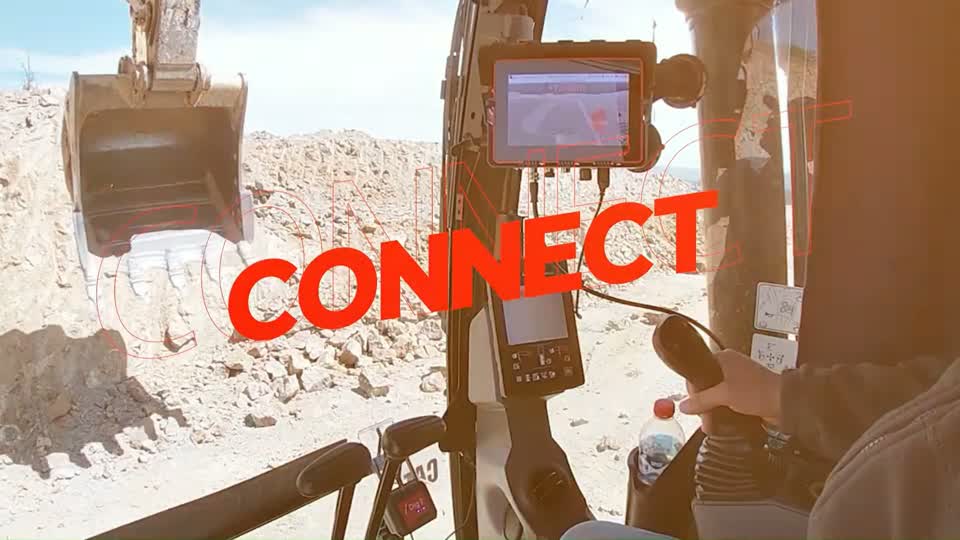
iDig 2D & 3D Wireless Excavator Machine Control
More iDig videos
Which iDig Is This?
iDig makes two families. Thirty seconds here saves you reading the rest of the page wondering which one you are looking at.
iDig TOUCH 2D
Single-axis guidance with the software already included — nothing further to buy. The straightforward choice if you want depth and slope on an excavator and nothing more.
iDig CONNECT 2D+
Multi-axis, reading ten times faster over Bluetooth 5, able to work from a GPS height reference, and able to grow into 2D PROJECT and full 3D later on the very same hardware.
How CONNECT is licensed, in one line. The hardware is bought once. What it is allowed to guide is unlocked by a one-time software license per machine type — excavator, or skid steer. The package at the top of this page already includes the Skid Steer Software, so it is a complete, working system for a skid steer or track loader. Nothing further is required.
Everything in the software table further down is optional and can be added any time, on the same control box. You are not choosing it now.
Everything You Need To Work To Grade
- CT700iDig CONNECT 2D+ System — factory part number 14000700
- BT4072 × Bluetooth Mini Angle Sensor Kits — solar rechargeable, magnetic mount
- BT4111 × Bluetooth Combo Angle / Laser Sensor Kit
- BT4081 × 2D Bluetooth Mini 2D/3D Chassis Sensor Kit — automatic pitch and roll compensation
- CT157Skid Steer Software — factory part number 14000157, one-time fee, included in this package
- 7″ sunlight-readable tablet — 7″ sunlight-readable screen, 800 × 480 px
- LED bargraph in-cab guidance display
- CONNECT 2D+ software, v5
Three Packages. One Set Of Hardware.
This is the Skid Steer Package — it lets you run iDig on your skid steer or track loader for 2D+ work on the job site. Below it are two more: one built strictly for an excavator, and a combo that lets you run iDig on both machines from the same control box.
Every package below includes the complete CT700 system — control box, LED bargraph and all four wireless solar sensors — plus a one-time software licence. The licence is bought once. There is no subscription and no annual fee.
A base station / GNSS receiver is REQUIRED on the skid steer package. It is not an upgrade and it is not optional — it is how the system works on a skid steer. An excavator can run from a rotating laser. A skid steer cannot: it takes its height and position from satellites, so a GNSS receiver has to be on the cab. Confirmed directly by iDig North America.
There are two ways to cover it, and the difference is what you can do when you climb out of the machine:
- CT140TSpotMan GNSS receiver — $6,000. The receiver on its own. Everything the skid steer needs, nothing more.
- CT140T-KSpotMan Rover Kit — $6,500. The same receiver plus the rover rod, backpack, field tablet and iPoint software. For $500 more it comes off the machine and works as a survey rover — setting out, checking levels and volume calculations without a separate crew.
Most buyers take the kit. Call 1-877-866-5721 and we will spec it against your machine and your site.
Budget for the correction service too, and we would rather you heard it from us. A single receiver gets its position from satellites, but satellites alone are only accurate to about a metre. Getting to grade accuracy needs a correction source. There are two ways to cover it and the cost is very different.
Subscription service
One receiver, taking corrections from a network over cellular.
$85 / month, or $750 / year per licence. True RTK — the tier this system needs.
Best for: one machine, on sites with reliable cell coverage.
Your own base station
A second receiver set on a fixed point on your site, broadcasting straight to the machine.
No monthly or yearly fee at all. Approx. $6,000 once for the second unit.
Best for: two or more machines, or anywhere cell signal is unreliable.
Why the base station has no fee. There are only two ways to get correction data: rent it from somebody else's network, or make it yourself. A base station sits on a fixed point on your site and broadcasts corrections straight to the machine, so there is no network in the middle and nothing to subscribe to. One base serves as many machines as you run. It also keeps working where there is no cell signal, which a subscription will not.
If you go the subscription route, it has to be True RTK. Correction services come in tiers and the cheaper one is not accurate enough for grade — it holds about four inches, which is fine for mapping a site and useless for finishing one. True RTK holds 1–3 cm, and that is what this system needs. iDig recommend PointOne Nav: $85 per month, or $750 per year and save $270. PointOne run a 14-day free trial with no credit card, so you can prove it on your own site before you commit.
Call 1-877-866-5721 and we will work out which route is cheaper over five years for the number of machines you run.
iDig CONNECT 2D System with Excavator License
CT700hardware $9,750 + CT156one-time licence $4,700
Retail $14,450 — you save $675
Priced as 2D — works from a rotary laser or a benchmark. Steps up to 2D+ by adding a base station or GPS rover — no further iDig licence needed. Full 3D does need one.
iDig CONNECT 2D+ System with Skid Steer Software
CT700hardware $9,750 + CT157one-time licence $3,700
2D+ operation — a skid steer works from satellites, so a base station or GPS package is required. Upgradeable to 3D with a licence.
iDig CONNECT COMBO System — 2D Excavator + 2D+ Skid Steer
CT700hardware $9,750 + CT156 + CT157one-time licence $8,400
Retail $18,150 — you save $1,155
2D on the excavator, 2D+ on the skid steer. The skid steer side will not operate without a base station or GPS package. Upgradeable to 3D with a licence.
Side by side
| Package | Part number | Guides | CT700 hardware | One-time licence | Our price |
|---|---|---|---|---|---|
| iDig CONNECT 2D System with Excavator License | iDig-CT700-CT156 | Excavator Priced as 2D · 2D+/3D ready | $9,750 | $4,700 | $13,775.00 save $675 |
| Skid Steer SoftwareYOU ARE HERE | iDig-CT700-CT157 | Skid steer / track loader 2D+ · base station or GPS required | $9,750 | $3,700 | $13,450.00 |
| iDig CONNECT COMBO System — 2D Excavator + 2D+ Skid Steer | iDig-CT700-CT156-CT157 | Excavator and skid steer 2D excavator · 2D+ skid steer · base station or GPS required | $9,750 | $8,400 | $16,995.00 save $1,155 |
The licence unlocks a machine type, not a single machine — the control box stores up to 100 machines. Adding a second machine of a type you are already licensed for needs an Additional Machine Kit (BT531), not another licence.
It starts at 2D+. It does not end there.
What this page prices is 2D+. A skid steer takes its grade reference from satellites rather than a laser, which is why a base station or GPS package is part of the job. The package above is complete as sold — the one thing it does not include is the rotary laser it works from, and we sell those too.
Your machine starts at 2D+ and steps up once more, and that step is a software licence on the tablet you already own. Nothing you buy today gets replaced or traded in. What does change is how the machine knows where grade is, and that is what the three modes below are really about.
2D — not available on a skid steer
Reference: a rotary laser, or a benchmark you shoot once.
Accuracy: ± 3/8 inch. The most accurate of the three.
Why it does not apply here. 2D reads a rotating laser through the BT411 sensor on an excavator stick. A skid steer has no stick, and its BT411 stays in the case — which is why a skid steer starts at 2D+ rather than 2D.
A skid steer cannot run 2D — ever. It is shown here only so you can see why the ± 3/8 in laser figure appears in iDig literature, and why your machine works to about an inch instead.
2D+ — what you are buying
Reference: GPS. No laser to set up, no benching, and no walking the machine back to a benchmark.
Accuracy: about 1 inch — roughly the width of a golf ball. Slightly less accurate than the laser.
Needs: a base station or GPS rover. No further iDig licence — the hardware is what unlocks it. Buy the $6,500 rover kit and the rover’s own iPoint software is included; buy the $6,000 receiver on its own and that software is separate. That is the $500.
3D — working to a design
Reference: GPS, plus an engineer's design model loaded into the tablet.
Accuracy: about 1 inch, the same as 2D+.
Needs: a base station or GPS package, plus the 3D licence — CT1503D Lite or CT151full 3D, both priced in the software table below — and a CAD or LandXML file for the job.
Worth knowing before you spend the money. People assume GPS is the more accurate option. It is not. The laser holds a tighter line, and 2D is the cheapest of the three. What GPS buys you is freedom — no laser to set up or move, no re-benching, and the receiver works anywhere on the site. That is why a skid steer has to use it, and why on an excavator it is a choice rather than a requirement.
Specifications
| Power supply — sensors | Solar rechargeable battery |
|---|---|
| Sensor protection | IP67 waterproof |
| Sensor size range | 2.25 × 3 × 1 in to 2.75 × 4 × 1 in (55 × 75 × 25 mm to 70 × 100 × 25 mm) |
| Accuracy | About 1 inch (GNSS). iDig’s ± 3/8 in figure is for laser work on an excavator — a skid steer works from satellites. |
| Sensor communication | Bluetooth 5 |
| Position update rate | 100 Hz (100 measurements per second) |
| Sensor capability | Multi-axis |
| Memory | Up to 100 machines, up to 100 buckets per machine |
| Operating temperature | −20 °C to 70 °C (−4 °F to 158 °F) |
| Tablet screen | 7″ — 800 × 480 px |
| Power input | 9 V – 27 V, cigarette lighter |
| Installation time | 3 – 4 hours (self-install) |
| Move between machines | About 5 minutes, with an additional machine kit |
| Height reference | GNSS (required on a skid steer) |
| Tilt bucket option | +1 sensor |
| Warranty | 1 year (optional extension available) |
Specifications from the iDig CONNECT 2D & 3D brochure and the iDig North America TOUCH 2D vs CONNECT product comparison, current as of September 2026.
Where It Goes On A Skid Steer
Three sensors, the tablet and the GNSS receiver. They sit on magnetic plates, charge from daylight and talk to the cab over Bluetooth 5 — nothing welded, no cable run through the machine. Budget three to four hours for a first install.
Skid steer arm BT407
Reads arm angle. Magnetic plate, no welding, no wiring.
Bucket BT407
Mounted on the back of the bucket, out of the way where it will not get knocked. Arm and bucket together are what tell the tablet where your cutting edge is.
In the cab BT408
Machine pitch and roll, compensated automatically, so grade stays true when the machine is not sitting level. Every iDig machine carries one of these.
In the cradle CT700
The 7″ sunlight-readable tablet and the LED bargraph, set in your field of vision. The tablet lifts out and moves to the next machine.
5 — on the cab roof
The GNSS receiver. This is the one that makes a skid steer work. An excavator reads a laser. A skid steer reads satellites, so this is your height and position reference and the system does not operate without it. Plenty of buyers already own a base station or GPS rover — if you do, yours may well work. Both options are priced below, or call 1-877-866-5721 and we will check yours against it.
One sensor in the box does not go on a skid steer. The CT700 kit ships a BT411 combo angle/laser sensor. That one is the laser receiver for an excavator — a skid steer works from GNSS, not from a laser, so it stays in the case. You are not missing anything and nothing is wrong with your kit.
Placement, sensor count and install time confirmed directly by iDig North America, October 2026.
The Work A Skid Steer Actually Does
Set the reference once — off a benchmark, a laser or a GPS elevation — and the bargraph works the cutting edge to target. These are the modes iDig lists for CONNECT, written for the jobs a skid steer gets put on.
Level
One flat plane held across the whole area — building pads, shop floors, subgrade under concrete, and parking areas that have to come out dead flat.
Slope
A constant fall in one direction. Driveways, aprons, ramps and hardstanding that has to shed water the way the drawing says.
Dual slope
Two independent slope planes at once — crowned lots, cross-fallen roads and anything that has to drain to a corner rather than an edge.
Trench
Consistent depth down a run, for skid steers doing their own trench work and backfill.
Drainage
Fall held to a set gradient over distance — the one that gets dug up and done twice when it is wrong.
What this is. CONNECT 2D+ is operator guidance. The screen and the LED bargraph tell the operator where the cutting edge sits against the grade they set, on every pass, without anyone leaving the cab to check it.
Modes per the iDig North America Skid Steer Combo brochure (Level, Slope / Dual Slope, Trench / Drainage), September 2026.
The Six Systems
These are the hardware systems on their own. TOUCH 2D ships ready to work. CONNECT systems are licensed separately — see the software table below, or buy the CONNECT 2D+ Skid Steer Package at the top of this page, which already has the skid steer software priced in.
| Part No. | Model | System | Sensors | Software | Price |
|---|---|---|---|---|---|
| 13003701 | XD610 | iDig TOUCH 2D Excavator Guidance System | 2× XD407 · 1× XD411 · 1× BT408 | Included | $10,900 |
| 13003703 | XD611 | iDig TOUCH 2D Excavator Guidance System with Big Combo | 2× XD407 · 1× XD437 · 1× BT408 | Included | $11,525 |
| iDig-CT700-CT156 | CT700 + CT156 | iDig CONNECT 2D+ with Excavator License | 2× BT407 · 1× BT411 · 1× BT408 | Excavator | $13,775 |
| iDig-CT700-CT157 | CT700 + CT157 | iDig CONNECT 2D+ with Skid Steer SoftwareYOU ARE HERE | 2× BT407 · 1× BT411 · 1× BT408 | Skid steer | $13,450 |
| iDig-CT700-CT156-CT157 | CT700 + both | iDig CONNECT 2D+ Combo System | 2× BT407 · 1× BT411 · 1× BT408 | Excavator + skid steer | $16,995 |
| 14000701 | CT701 | iDig CONNECT 2D+ Big Combo System | 2× BT407 · 1× BT437 · 1× BT408 | License required | Call |
System Components
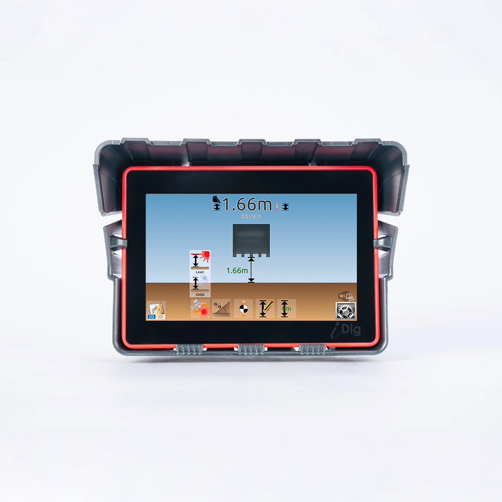
Control Box — 7″ Tablet
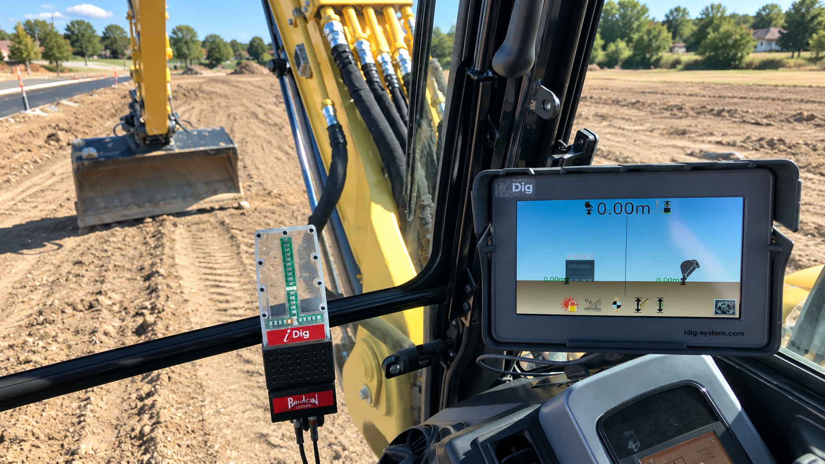
A rugged 7″ tablet (800 × 480 px) running iDig's patented software, built with and for excavator operators. Level surface, single or dual slope, dig reach and side distance, height alert and measuring tape all live on one interface. It sits in a cradle and transfers between machines.
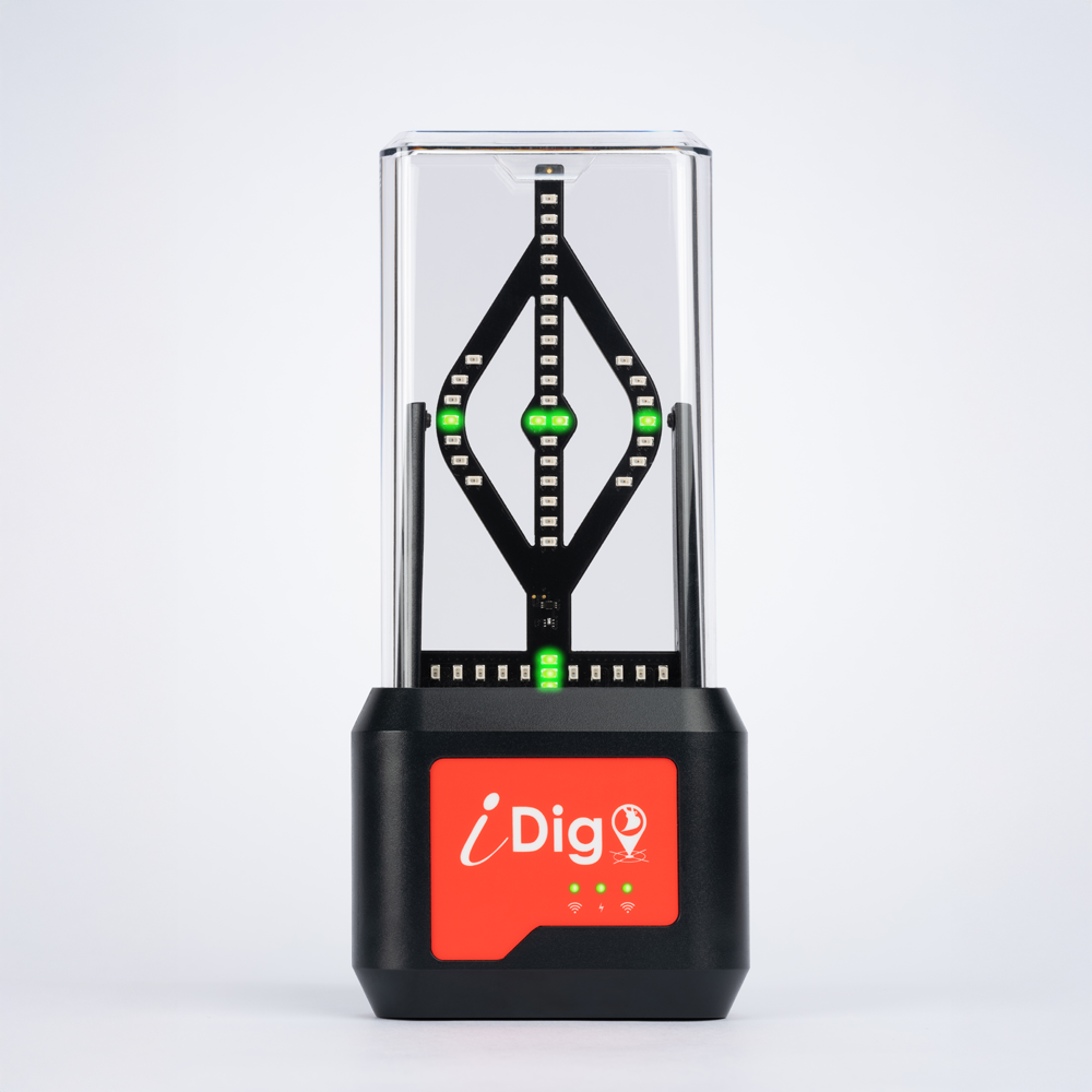
LED Bargraph
An assistant that sits in your field of vision. Green, red and orange LEDs tell you where the cutting edge is against grade without looking away from the work, plus extra LEDs for tilt and rotate when a supported tiltrotator is fitted.
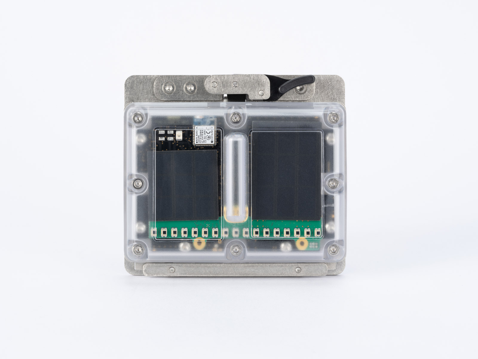
Wireless Solar Sensors
Solar-rechargeable, IP67 waterproof, 55×75×25 mm to 70×100×25 mm. They snap onto the machine on magnetic plates and unclip to move to the next one. The combo sensor doubles as a laser receiver for elevation reference.
Wireless, Solar, and Built To Grow
These are the things CONNECT does that a conventional 2D system does not.
Completely Wireless
Sensors communicate over Bluetooth 5 and run on solar-rechargeable batteries. Nothing is welded to the machine and no cables are run — which is why installation takes one to two hours instead of a day in a shop.
100 Measurements Per Second
CONNECT reads position 100 times a second — ten times the rate of a conventional 1-axis 2D system — across multi-axis sensors. That is what makes the guidance feel immediate rather than laggy behind the bucket.
One System, The Whole Fleet
The sensors unclip and move to another excavator in about five minutes. The control box stores up to 100 machines with up to 100 bucket profiles each, so a second machine needs only an additional sensor plate kit.
Tilt and Rotate Ready
The bargraph carries additional LEDs for tilt and rotate information. iDig currently supports Steelwrist, Engcon, Rototilt, AMI, Kinshofer/NOX, Oil Quick, HOLP and HKS tiltrotators.
Remote Support and Updates
With the Bluetooth/WiFi adapter the system takes remote support sessions and software updates in the field — no trip to a dealer, no machine downtime.
Scales To Full 3D
CONNECT 2D+ steps up to CONNECT 2D PROJECT and then to full CONNECT 3D through software licenses alone. The hardware you buy today is the hardware you keep.
Why 2D+ Is The Right Starting Point
2D+ gives a skid steer satellite-referenced grade control without the cost and the paperwork of a full 3D workflow. For most contractors that is the whole job.
✓ No design file needed
3D needs an engineer's CAD model before it can do anything. 2D+ does not. You set the grade yourself from the cab and start moving dirt the same morning.
✓ Lower cost than 3D
The same hardware, the same receiver, a cheaper licence. You are not paying for project management tools you will never open.
✓ Fast setup on every job
Dial in your target depth or slope in seconds. Move site to site without reconfiguring anything.
✓ Easy for any operator
Built for operators, not surveyors. New operators are productive in a day; experienced ones are faster and more accurate immediately.
And when you do need 3D, it is a software licence on the tablet you already own. The receiver, the sensors and the bargraph all stay exactly where they are.
Add Capability When The Work Asks For It
One optional licence matters on a skid steer. It is a one-time fee on the tablet you already own — no new hardware, no new system.
Attachments
Adds support for a grader attachment — the Level Best style box that does the finish work. Needed when you want the system guiding the attachment rather than the bucket.
CT154Optional software license
What you do not need. A plain bucket, a grading bucket, a box blade and a dozer blade all work with the package as sold — no extra licence. An auger needs nothing either; iDig treat it as just another bucket profile. Only the grader attachment needs the licence above.
Coming, not here yet. iDig are working with Level Best on automatics, so the grader attachment will raise and lower itself rather than just telling the operator where it is. Not released. We will say so plainly the day it is.
Confirmed with iDig North America, October 2026. Dynamic Laser Catch (CT155) and Swing Boom Assistance (CT145) are excavator-only — a skid steer has no laser to catch and no boom to swing — so they are not listed here.
CONNECT Software — One-Time Licenses
Every license below is a one-time fee for CONNECT systems running v5 software. TOUCH 2D does not use these — its software is included with the system.
| Part No. | Model | License | Applies To | Price |
|---|---|---|---|---|
| 14000156 | CT156 | Excavator License | CONNECT with v5 software — the excavator licence | $4,700 |
| 14000157 | CT157 | Skid Steer Software | CONNECT with v5 software — included in the package at the top of this page | $3,700 |
| 14000154 | CT154 | Attachments Software | CONNECT with v5 software — tilt bucket, blade, auger, clamshell | $3,700 |
| 14000145 | CT145 | Swing Boom Assistance | CONNECT with v5 software — excavator only | $990 |
| 14000155 | CT155 | Dynamic Laser Catch | CONNECT with v5 software — excavator only | $820 |
| 14000150 | CT150 | 3D Lite Software | Step up from 2D to 3D Lite | $2,025 |
| 14000151 | CT151 | 3D Software | 3D license for CT700 and CT701 | $5,500 |
| 14000137 | CT137 | 3D Lite to 3D | Step up from 3D Lite to full 3D | $4,000 |
Start Here. Step Up When The Work Demands It.
CONNECT is one hardware platform. Moving from 2D+ to 2D PROJECT to full 3D is a software license, not a new system — so the money you spend today stays in the machine.
| Capability | CONNECT 2D+ | CONNECT 2D PROJECT | CONNECT 3D |
|---|---|---|---|
| This page | ★ THIS SYSTEM | — | — |
| Dynamic algorithm (laser catch, swing boom) | ✓ | ✓ | ✓ |
| Intuitive user interface | ✓ | ✓ | ✓ |
| Wireless sensor communication | ✓ | ✓ | ✓ |
| Multi-machine compatibility | ✓ | ✓ | ✓ |
| Single GNSS positioning | ✓ | ✓ | ✓ |
| Internet base station correction | ✓ | ✓ | ✓ |
| Remote support | ✓ | ✓ | ✓ |
| Dig with or without designs | ✓ | ✓ | ✓ |
| Create 3D in-field designs | ✗ | ✓ | ✓ |
| Point, line and surface creation (3D) | ✗ | ✓ | ✓ |
| 3D design imports (DXF, LandXML) | ✗ | ✓ | ✓ |
| Large-scale projects (5+ projects over 500 m) | ✗ | ✗ | ✓ |
| 3D visualisation of design & bucket | ✗ | ✗ | ✓ |
| Files per project | NA | 1 | Limited by memory |
| Projects in control box | NA | 5 | Limited by memory |
| Max project size | NA | 22,500 m² / 500 m | Limited by memory |
SpotMan GNSS — Height Reference and Rover In One
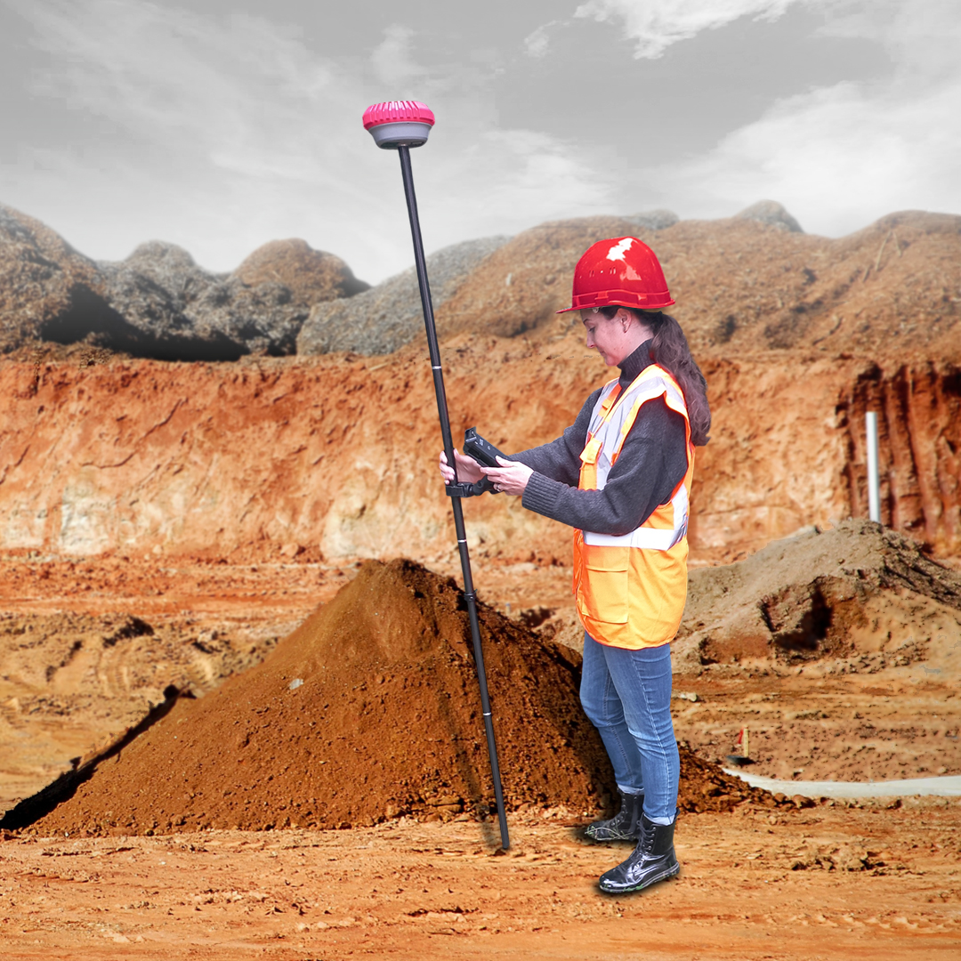
Pair CONNECT 2D+ with SpotMan and the GNSS receiver replaces the laser as your height reference — then detaches from the machine and works as a pole-mounted survey rover. Surveying, setting out and volume calculation, without a separate crew.
- IP67 dustproof and waterproof, rated to survive a 2 m (6.5 ft) pole drop
- Calibration-free IMU tilt compensation, free from magnetic interference
- Up to 1,408 signals — GPS, GLONASS, Galileo, BeiDou and QZSS
- Built-in SIM slot for 4G, plus UHF radio, WiFi and Bluetooth
- Up to 34 hours RTK rover / 16 hours base, with external power support
- Configurable as a base station to broadcast corrections across the site
- Runs iPoint Android software for survey, stakeout and volumes
CT140T-KSpotMan Rover Kit — receiver, pole and case. Required when you step up to 3D, and the same unit doubles as your survey rover. Call 1-877-866-5721 for pricing.
TOUCH 2D vs CONNECT 2D+
Both are wireless, solar and self-installed. This is where they part company.
| Capability | TOUCH 2D | CONNECT 2D+ |
|---|---|---|
| Machines it guides | Excavator only | Excavator, skid steer and track loader |
| Operating modes | 2D — laser or benchmark | 2D, 2D+ (GPS), and 3D with a licence |
| Runs a skid steer | NA | ✓ with CT157, in 2D+ or 3D |
| Sensor capability | 1 axis | Multi-axis |
| Position update rate | 10 Hz | 100 Hz |
| Sensor communication | WiFi 2.4 GHz | Bluetooth 5 |
| Installation time | 1–2 hours | 1–2 hours |
| Height reference — ground | ✓ | ✓ |
| Height reference — laser | ✓ | ✓ |
| Height reference — GPS | NA | ✓ |
| Single / dual grade plane with GPS | NA | ✓ |
| Swing boom option | NA | ✓ |
| Remote support via Bluetooth/WiFi adapter | NA | ✓ |
| Remote software update | NA | ✓ |
| Sun shading | NA | ✓ |
| Vertical dig distance | NA | ✓ |
| Define bench known elevation | NA | ✓ |
| Tilt bucket option | +2 sensors | +1 sensor |
| Scales up to 2D PROJECT / 3D | NA | ✓ |
NA = not applicable to that model. Source: iDig North America, TOUCH 2D vs CONNECT product comparison, September 2026.
Powered by iDig Systems
iDig designs, manufactures and distributes worldwide through a network of more than 50 partners. Headquartered in Le Mesnil-le-Roi, France and part of the Bridgin Group, iDig pioneered plug-and-play wireless machine control and has become a global leader in wireless 2D excavator guidance.
- Developed and manufactured in France
- Used on job sites across six continents
- Industry-leading plug-and-play design
- One platform that scales from 2D to full 3D GPS/GNSS
Frequently Asked Questions
Do I need a software license for every skid steer I put this on?
What is the difference between TOUCH 2D and CONNECT 2D+?
Do the sensors need wiring or welding to my machine?
What happens when the sensors run out of sun?
Can I add 3D later, or do I buy a new system?
Does it need a GPS base station or a correction subscription?
Downloads
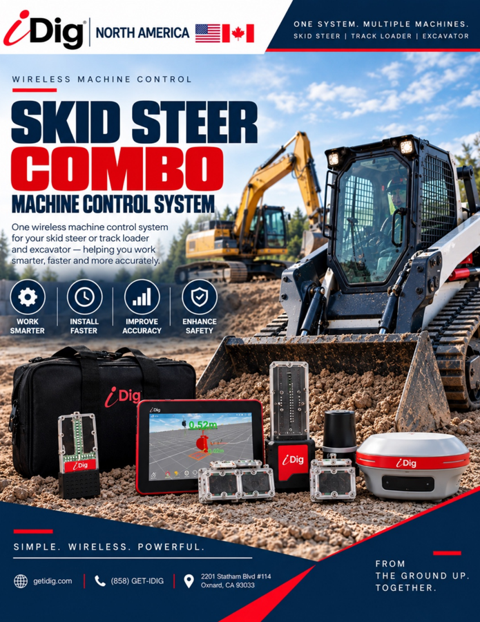
Skid Steer Combo Brochure
iDig North America's own sheet for skid steer and track loader machine control, including the system specifications.
Download PDF ↓
TOUCH 2D vs CONNECT
Every capability, feature and application side by side across all four configurations.
Download PDF ↓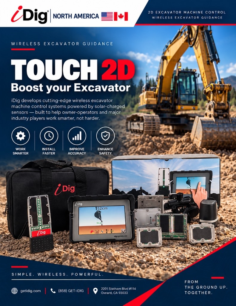
TOUCH 2D Brochure
Full product brochure for the wireless, solar-powered TOUCH 2D system.
Download PDF ↓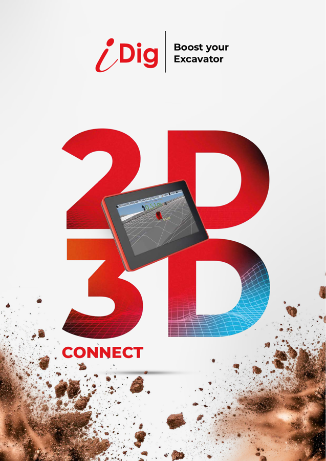
CONNECT 2D & 3D Brochure
Specifications and the full comparison across CONNECT 2D+, 2D PROJECT and 3D.
Download PDF ↓
Authorized iDig Dealer
Got questions? Give us a call.
1-877-866-5721Family Owned & Operated · Free Shipping · Same-Day Shipping · Real people who set these systems up every week
Experience the value of Great Customer Service!