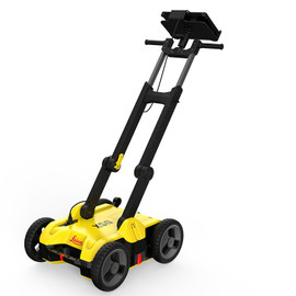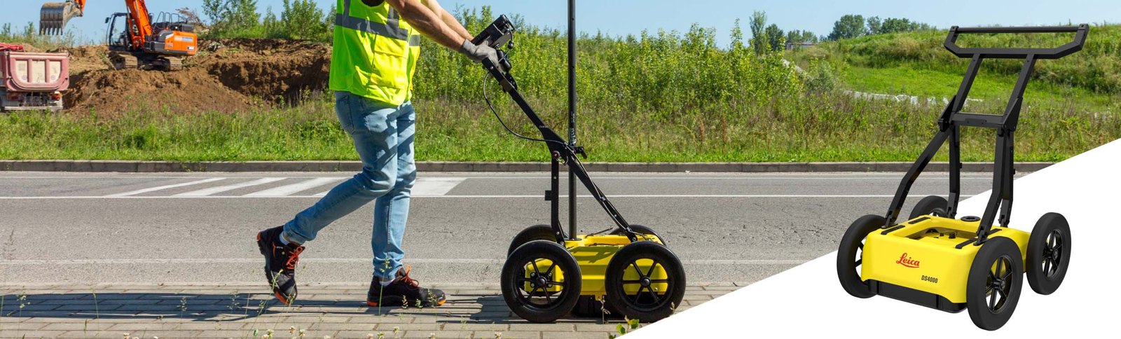
See more, reach deeper: find buried utilities up to 60% deeper than traditional GPR
Dual-frequency ground penetrating radar that shows shallow lines and deep pipe in one pass, marks targets on site and hands you the report before you leave. One person can run it.
- Dual 200 MHz and 900 MHz antennas with Leica’s patented EsT technology
- 44 lb, folds to 17 inch tall, one-person operation
- Hot-swap batteries: 8 hours with two
- IP65, runs from -4 °F to 122 °F
How it works: we help you choose and order, then Leica Geosystems ships the DS4000 to you and supports it directly.
Compare DS4000 packages
Three ways to buy the same radar. Pick the System if you already own the support gear, or a kit if you want the warranty and survey accessories in one box.
| DS4000 SystemLeica part 1023281 | DS4000 Starter KitLeica part 6019689 | DS4000 Surveyor KitLeica part 6019690 | |
|---|---|---|---|
| Leica list price | $16,900.00 | $21,265.00 | $22,962.00 |
| DS4000 utility detection radar | ✓ | ✓ | ✓ |
| Li-ion battery and charger | ✓ | ✓ | ✓ |
| 2-year warranty listed | Ask us | ✓ | ✓ |
| Set of 4 off-road wheels (15 inch airless) | — | — | ✓ |
| GLS30 carbon-fiber GNSS telescopic pole | — | — | ✓ |
| GNSS pole support | — | — | ✓ |
| GAD50 adaptor for mounting reflectors | — | — | ✓ |
| Best for | Adding a radar to gear you already own | Crews who want the 2-year warranty in the package | Rough ground and GNSS / total station mapping |
| What’s in the box (Leica’s wording) |
|
|
|
Swipe the chart sideways to see every package.
Contents are Leica’s wording from the Leica price list. Prices are Leica list and may change; call to confirm current pricing and the full box contents. Leica recommends the CT1500 tablet (sold separately). IQMaps office software is sold separately.
Tell us what you locate and the ground you work on. We place the order with Leica, and Leica ships and supports your radar directly.
How ordering works
Accurate data, fewer strikes
The DS4000 gives you a clear picture of the pipe and cable network under your site, so your crew digs with confidence, avoids excavation strikes and keeps the schedule on track.
See deeper
Leica’s patented EsT (Equalized Scrambled Technology) finds underground assets up to 60% deeper than traditional systems.
Shallow and deep in one pass
Dual 200 MHz and 900 MHz antennas: fine detail near the surface and reach for deeper pipe, on the same scan.
Finds the hard-to-see lines
Leica built it to reveal difficult targets such as fiber optic cables.
A one-person cart
44 lb with a foldable handlebar and a large handle. One operator can move it, load it and run it.
Runs the whole shift
Hot-swap batteries keep you collecting with no shutdown: about 4 hours per battery, 8 hours with two.
Quick Scan Mode
A faster way to clear an area that saves time in the field and lowers the cost of the job.
Mark it on the spot
uMap shows the radar picture and time slices in real time, so you mark targets on the ground as you find them.
Leave with the report
uMap writes the report automatically, so you finish and hand it over on site.
Built for jobsites
IP65, works from -4 °F to 122 °F and meets IEC shock and vibration standards.
Rough ground ready
Swap the 12 inch wheels for 15 inch airless off-road wheels, and raise the antenna to clear obstacles.
Ties into your survey gear
Position by wheel encoder, GNSS or total station, with a mount for a GNSS antenna or reflector.
CAD-ready deliverables
IQMaps processes the scan in 3D and exports straight to AutoCAD.
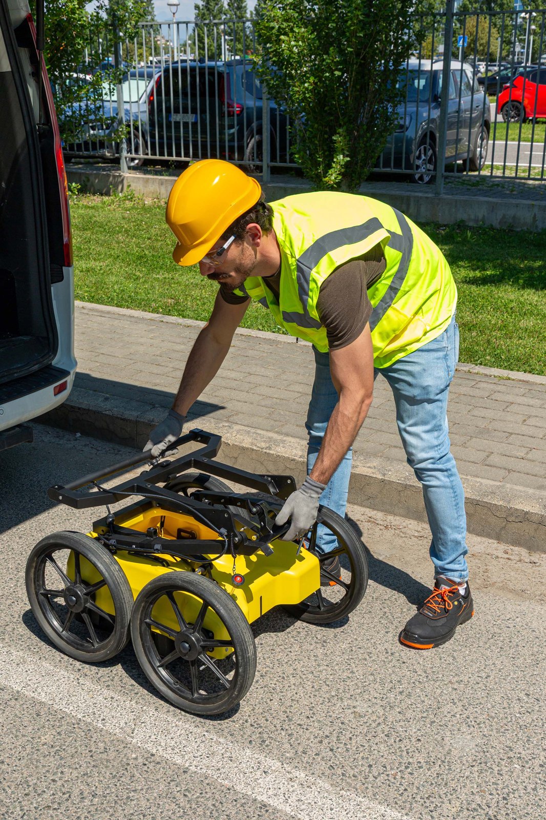
Designed to perform
- 20 kg (44 lb) and easy for one person to move and transport
- Handlebar folds: 750 x 625 x 420 mm (30 x 25 x 17 inch) for the truck
- Height-adjustable dual-frequency antenna mount clears obstacles
- Hot-swap batteries for uninterrupted data collection all day
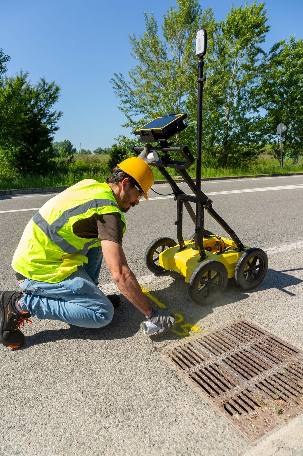
Key benefits in the field
- Switch antenna polarization between HH and VV for the best result on each target
- Mark targets and record them digitally in real time
- Georeference with GNSS or a total station reflector on the cart
- Finish the report on site with uMap
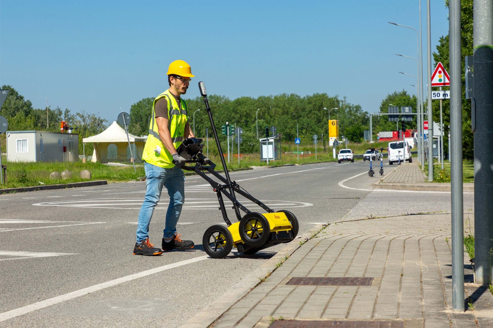
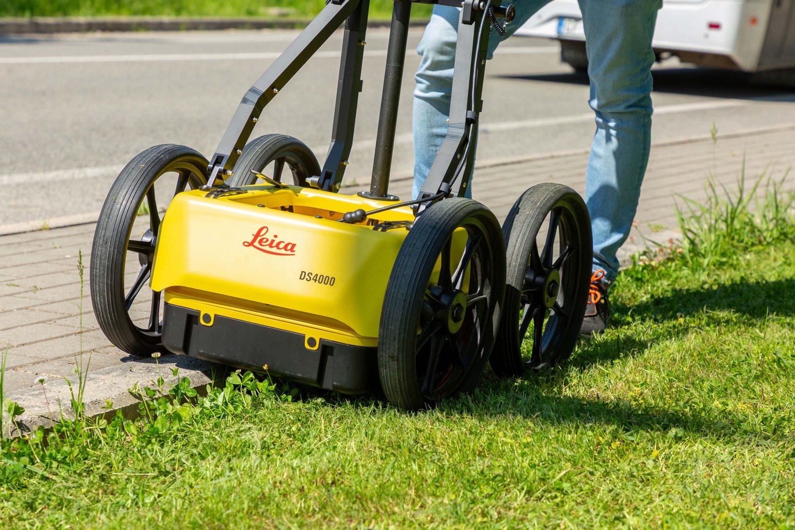
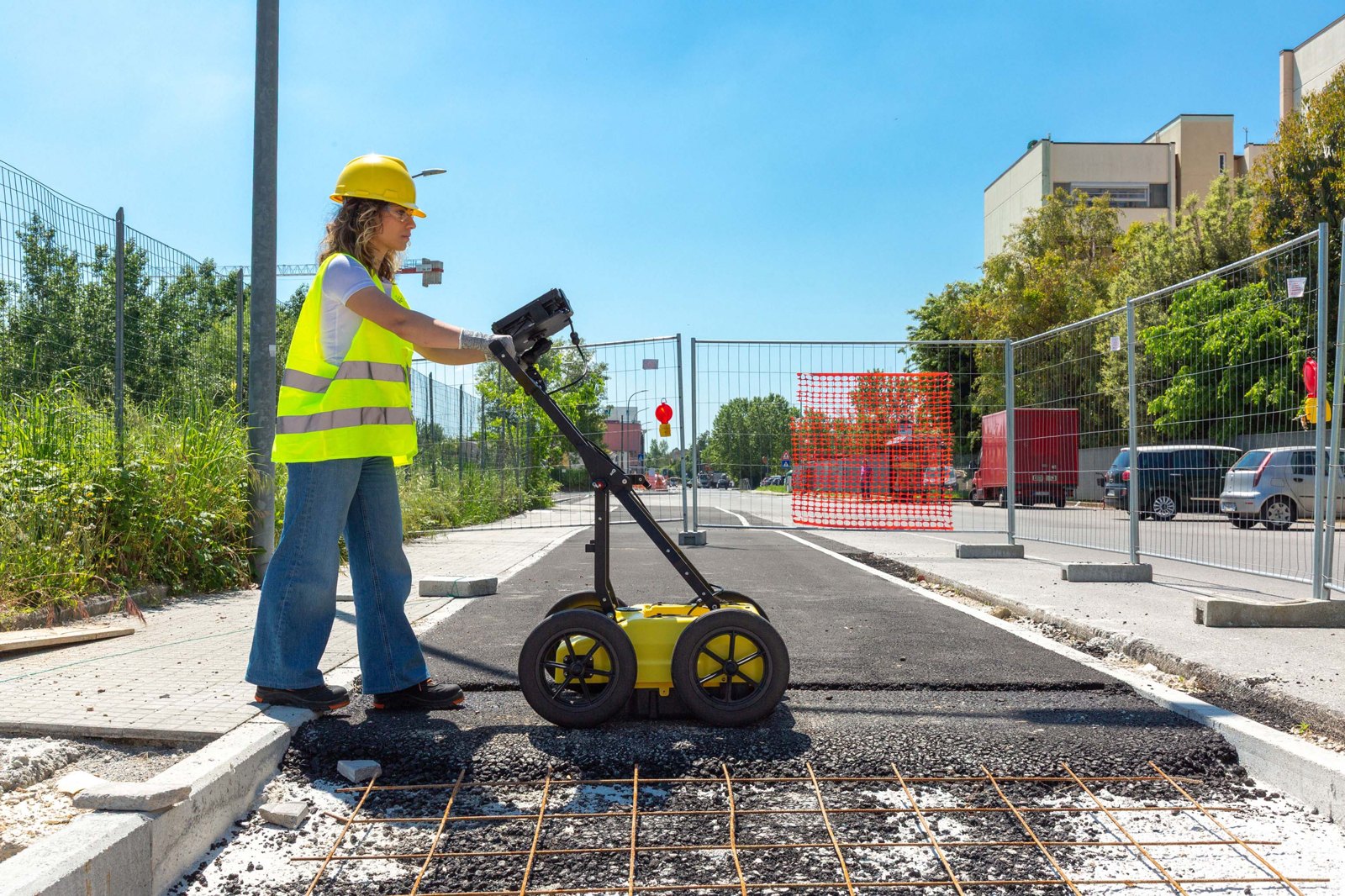
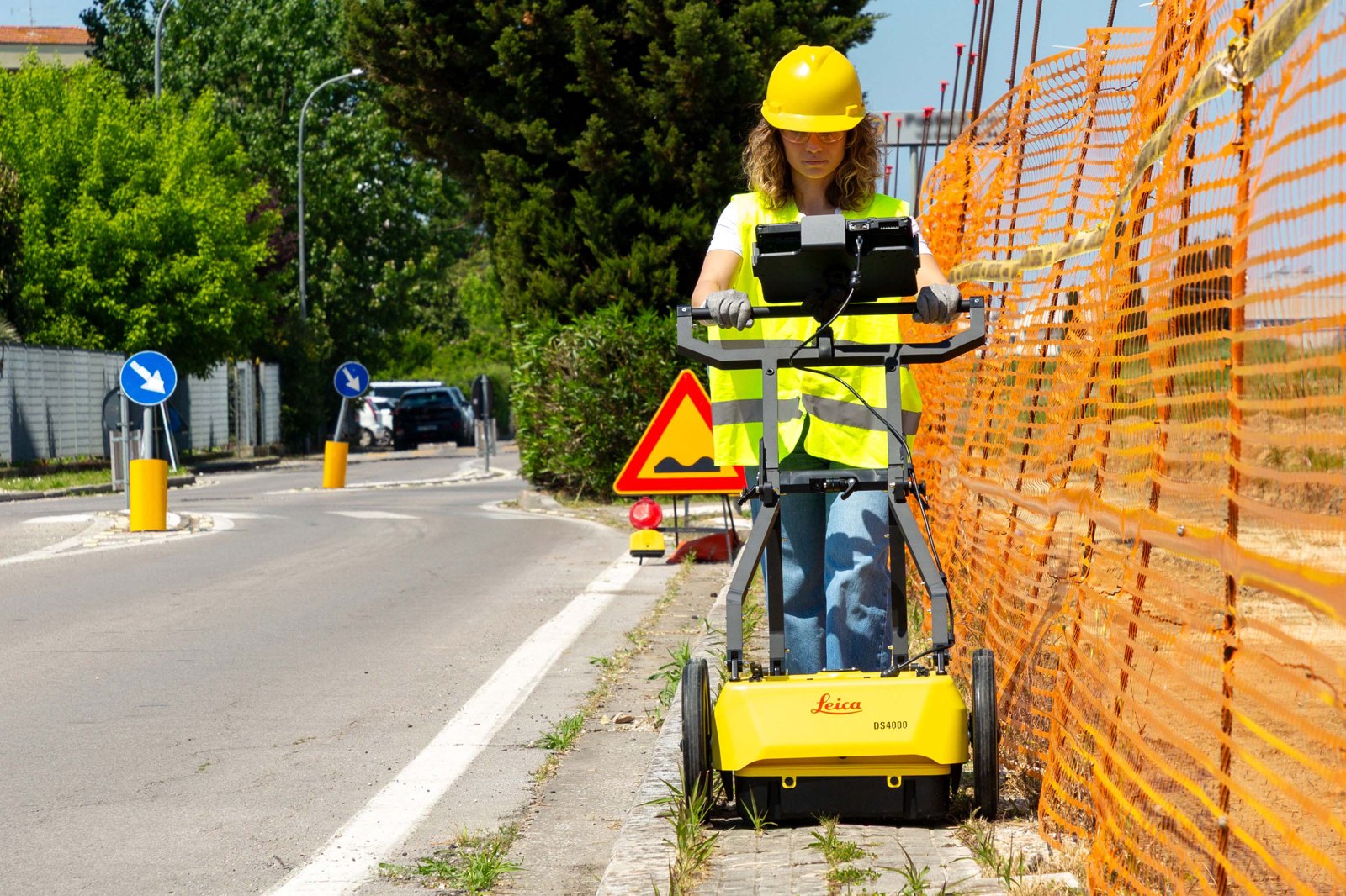
See the DS4000 at work
Leica Geosystems: DS4000 Utility Detection system (2:13). Dual-frequency antennas, swappable wheels for flat and rough ground, one-person operation.
Scan, mark and map: uMap in the field, IQMaps in the office
1. Scan with uMap
Automatic calibration for a quick start, Quick Scan Mode, and real-time radar tomography (time slices) on the tablet. Import site cartography to see asset positions geo-referenced in real time. Metric and imperial units.
2. Mark and report on site
Mark targets on the ground as you find them, record them digitally, and let uMap generate the report automatically. Export, store and share on major cloud services.
3. Process in IQMaps
Advanced 3D processing with a direct export link to AutoCAD. Georeferenced data and anomaly detection, with no limit on software use for large areas. Sold separately: 1-year subscription or weekly rental.
Complete the locate
Leica DS4000 specifications
| Radar | |
|---|---|
| Channels | 2 |
| Central frequencies | Dual 200 MHz and 900 MHz |
| Inspection range | 80 MHz to 1500 MHz |
| Technology | EsT – Equalized Scrambled Technology (patented) |
| Polarization | HH and VV, easy switch |
| Depth | Up to 60% deeper than traditional systems (Leica publishes no absolute depth; depends on soil) |
| Positioning | Wheel encoder, external GPS / GNSS, total station |
| Physical | |
| Weight | 20 kg (44 lb) |
| Size in use | 750 x 625 x 1000 mm (30 x 25 x 40 inch) |
| Size folded for transport | 750 x 625 x 420 mm (30 x 25 x 17 inch) |
| Wheels | 4 x 310 mm (12 inch) standard; 4 x 380 mm (15 inch) airless off-road optional |
| Power | |
| Power consumption | Acquisition 16 W; stand-by 12 W |
| Operating time | 4 hours with 1 battery; 8 hours with 2 batteries; hot swap |
| Environment | |
| Operating temperature | -20 °C to +50 °C (-4 °F to +122 °F), IEC 60068 2-1/2 |
| Protection | IP65 |
| Vibration | IEC 60068-2-64:2012 |
| Shock | IEC 60068-2-31:2011 |
| Certifications | CE, UKCA, FCC, IC |
| Software and tablet | |
| Field software | uMap: calibration, real-time tomography, NMEA positioning, target marking, automatic reports |
| Office software | IQMaps 3D processing with direct AutoCAD export (sold separately) |
| Recommended tablet | Leica CT1500 (sold separately) |
Sources: Leica DS4000 data sheet (2025), Leica DS4000 brochure (2025), Leica DS4000 product page, Leica price list. No figure on this page comes from anywhere else.
Leica DS4000 vs Leica DSX: which radar?
Both are Leica utility detection radars that Contractors-Tools.com can help you order. Here is how they compare, from Leica’s own documents.
| Leica DS4000 (this page) | Leica DSX | |
|---|---|---|
| Made for | Crews who want dual-frequency radar, real-time tomography in uMap and 3D processing in IQMaps | Crews new to GPR: DXplore reads the radar and builds the 3D utility map on site |
| Antenna | Dual 200 MHz and 900 MHz, 2 channels, HH / VV polarization | Single 600 MHz, 1 channel |
| Depth | Up to 60% deeper than traditional systems (Leica gives no absolute depth) | Up to 2 m (6.56 ft), depending on soil |
| Weight | 20 kg (44 lb) | 23 kg without battery and tablet |
| Battery | 4 hours per battery, 8 hours with two, hot swap | Up to 8 hours per battery |
| Operating temperature | -20 to +50 °C (-4 to +122 °F) | -10 to +40 °C (14 to 104 °F) |
| Protection | IP65 | IP65 |
| Tablet in the kits | No: Leica recommends the CT1500, sold separately | Yes: CT1000 in every Starter and Surveyor kit |
| Office software | IQMaps (sold separately) with direct AutoCAD export | DXplore licence in every kit; DXF, DWG, SHP and PDF export |
| Leica list price | System $16,900; kits from $21,265 | System $13,915; kits from $18,445 |
Tell us who will run it and what you need to hand the client. We will point you to the right radar and package.
DS4000 documents
More Leica at Contractors-Tools.com: Leica Geosystems at Contractors-Tools.com • Locators and underground detection.
Leica DS4000 questions, answered
How deep can the Leica DS4000 see?
Depth always depends on the soil. Leica does not publish a depth in feet or metres for the DS4000. It says the DS4000 finds underground assets up to 60% deeper than traditional systems, and its patented EsT technology boosts penetration depth by 40% to 60% compared to traditional devices.
What frequencies does the DS4000 use?
Two channels with dual 200 MHz and 900 MHz central frequencies, and an inspection range of 80 to 1500 MHz. The 900 MHz channel shows shallow lines in detail and the 200 MHz channel reaches deeper pipe.
How heavy is it, and can one person run it?
It weighs 20 kg (44 lb). Leica says it can be easily maneuvered and transported by a single operator, and the handlebar folds so the unit is 17 inch tall for transport.
How long does the battery last?
About 4 hours on one battery and 8 hours with two. The batteries hot swap, so you can keep collecting data all day without shutting down.
Does the DS4000 work in rain and cold?
It is rated IP65 and operates from -20 to +50 °C (-4 to +122 °F). It also meets IEC shock and vibration standards.
What software comes with the DS4000?
uMap is the field software for data collection: Quick Scan Mode, real-time tomography, on-site target marking and automatic reports. IQMaps is the office post-processing software and is sold separately as a 1-year subscription (5311652) or a weekly rental licence (907492).
Can I get the results into AutoCAD?
Yes. IQMaps processes the radar data in 3D and has a direct export link to AutoCAD, so you can turn radar data into a CAD file.
Can I geo-reference the data with my GPS or total station?
Yes. The DS4000 positions by wheel encoder, external GPS / GNSS or total station. uMap connects to NMEA positioning devices, and the cart has a support for mounting a GNSS antenna or a total station reflector. The Surveyor Kit includes the GLS30 pole, pole support and GAD50 reflector adaptor.
What tablet do I need?
Leica recommends the CT1500 tablet. It is not included in any DS4000 package and is sold separately (1017209 with LTE for the US and Canada). Call us and we will add it to your order.
What is the difference between the three DS4000 packages?
The System (1023281) is the radar with LAN cable, one battery plus charger and Quick Guide. The Starter Kit (6019689) lists the radar, a Li-ion battery, a charger with power cords and a 2-year warranty. The Surveyor Kit (6019690) adds a set of 4 off-road wheels, the GLS30 carbon-fiber GNSS pole, a GNSS pole support and the GAD50 reflector adaptor.
Will it work on rough ground?
Yes. It ships on 12 inch wheels, and you can swap on a set of 15 inch (380 mm) airless off-road wheels for rough terrain. The antenna height adjusts so you can clear obstacles.
Is the DS4000 certified for use in the US and Canada?
Leica lists CE, UKCA, FCC and IC certifications for the DS4000.
How do I order the DS4000?
Call Contractors-Tools.com at 1-877-866-5721. We help you choose the right package and place the order with Leica Geosystems, which ships the radar to you and supports it directly. That is why there is no Add to Cart button on this page.